Artificial Intelligence Tool Picterra

DESCRIPTION
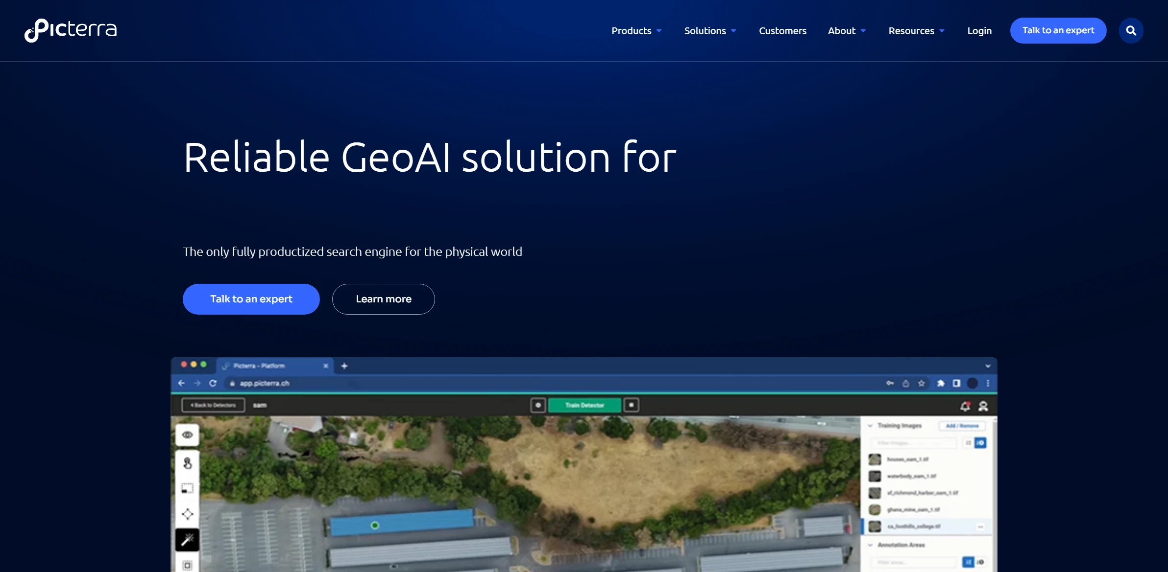
Picterra is an innovative artificial intelligence tool designed to facilitate the analysis and processing of geospatial imagery. By leveraging advanced machine learning algorithms, it enables users to extract valuable insights from satellite images, aerial photographs, and drones with unparalleled ease. Picterra’s user-friendly interface allows both seasoned professionals and novices to engage with the platform effectively. Users can train the AI model to recognize specific features or patterns within the imagery, making it an indispensable tool for industries such as agriculture, urban planning, and environmental monitoring.
One of Picterra’s key functionalities is its ability to perform automated object detection and classification. This feature allows users to train the AI to identify various elements within the imagery, such as buildings, vegetation, or water bodies. The practical impact of this functionality is significant; for instance, in agriculture, farmers can monitor crop health and detect early signs of disease by analyzing aerial imagery over time. This capability not only enhances decision-making but also optimizes resource allocation, ultimately leading to increased productivity and sustainability in agricultural practices.
Moreover, Picterra’s integration with cloud services ensures that users can access their projects and data from anywhere, fostering collaboration among teams. The platform supports various data formats, making it versatile for different use cases. By streamlining the analysis process and allowing for real-time updates, Picterra empowers organizations to respond swiftly to changing conditions, providing a crucial edge in today’s fast-paced environment. As a result, it stands out as a pivotal solution for those looking to harness the power of AI in geospatial analysis.
Why choose Picterra for your project?
Picterra stands out for its user-friendly interface that enables users to create custom AI models for geospatial data analysis without coding skills. Its unique ability to process satellite imagery allows for precise land use classification, environmental monitoring, and urban planning. Users can easily train models tailored to specific projects, enhancing accuracy in tasks like deforestation detection or crop health assessment. The tool’s collaboration features facilitate teamwork among researchers and organizations, while its integration capabilities with GIS platforms streamline workflows. Overall, Picterra empowers users to harness AI effectively for impactful insights in various sectors, from agriculture to conservation.
How to start using Picterra?
- Sign up for a Picterra account or log in if you already have one.
- Upload your geospatial data, such as satellite images or aerial imagery, to the platform.
- Choose the type of analysis you want to perform, such as object detection or land classification.
- Create and customize your training dataset by labeling the features or objects of interest in your images.
- Run the analysis and review the results, making adjustments as necessary to improve accuracy.
PROS & CONS
 Offers advanced machine learning capabilities for precise image analysis.
 User-friendly interface that simplifies the workflow for non-technical users.
 Supports a wide variety of geospatial data formats, enhancing versatility.
 Provides real-time collaboration features for team projects and data sharing.
 Integrates seamlessly with other GIS tools and platforms for enhanced functionality.
 Limited customization options compared to some advanced competitors, which may restrict specific user needs.
 Higher learning curve for new users, especially those unfamiliar with GIS or remote sensing technologies.
 Subscription costs can accumulate over time, making it less economical for small projects or individual users.
 Performance may vary significantly based on the size and complexity of the datasets, potentially leading to slower processing times.
 Limited integration capabilities with other software tools that some users may rely on for their workflows.
USAGE RECOMMENDATIONS
- Familiarize yourself with the Picterra platform by exploring its user interface and available features.
- Utilize the tutorials and documentation provided by Picterra to understand the tool’s functionalities better.
- Start with small projects to get a feel for how to create and train models effectively.
- Use high-quality training data to improve the accuracy of your models.
- Experiment with different algorithms and settings to see which provides the best results for your specific use case.
- Regularly evaluate the performance of your models and make adjustments as necessary.
- Leverage the community forums or support resources for troubleshooting and tips from other users.
- Integrate Picterra with other tools and platforms to enhance your workflow and data analysis capabilities.
- Keep an eye on updates and new features released by Picterra to stay up-to-date with the tool’s capabilities.
- Consider collaborating with team members to share insights and improve overall project outcomes.
SIMILAR TOOLS

Adobe Express
Adobe Express stands out as an advanced solution designed for solving complex problems efficiently. Built to overcome any technical challenge with ease.
Visit Adobe Express
Fotor AI
Generate professional-quality photos and graphics with this editing tool powered by advanced AI.
Visit Fotor AI
OpenAI – DALL·E 2.0
Discover the impact of OpenAI – DALL·E 2.0, completely transforming solving complex problems efficiently. A perfect choice for those who value excellence.
Visit OpenAI – DALL·E 2.0